Services
AuroraRadMap (ARM) System – Radiation Walkover Surveys
Data processing and results
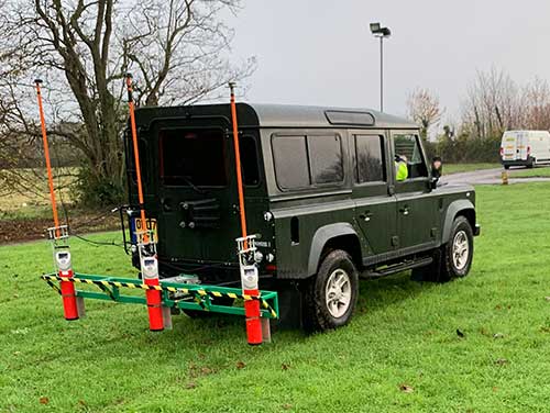
The instrumentation used consists of an extremely sensitive large volume 3”x3” Sodium Iodide gamma radiation detection system linked to a Global Positioning System (GPS). This ensures highly accurate gamma radiation contour mapping to demonstrate and validate the extent of potential radiological contamination.
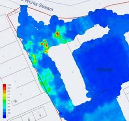
The data is translated for use to ArcGIS© (Geographical Information System). This GIS is used to display the gathered data in map form, allowing survey results to be displayed so they can be easily understood.

The picture below shows the results from 20,000 individual radiation reading over an area of 2 hectares.
Undertaking a “scanning” or “walkover survey” of a site using the AuroraRadMap system, with its 3”x3” Sodium Iodide detector linked to GPS, will aid in assessing the relative levels of radioactivity present and indicate the distribution of contamination. This type of system is recommended by regulators and industry guidance for large area land surveys and provides essential information on the location of contamination to assist the planning of ground investigations and development works.
The survey methodology meets the expectations of the the UK’s environmental agencies

Aurora
Our Work
Latest Case Studies
Contact Us
